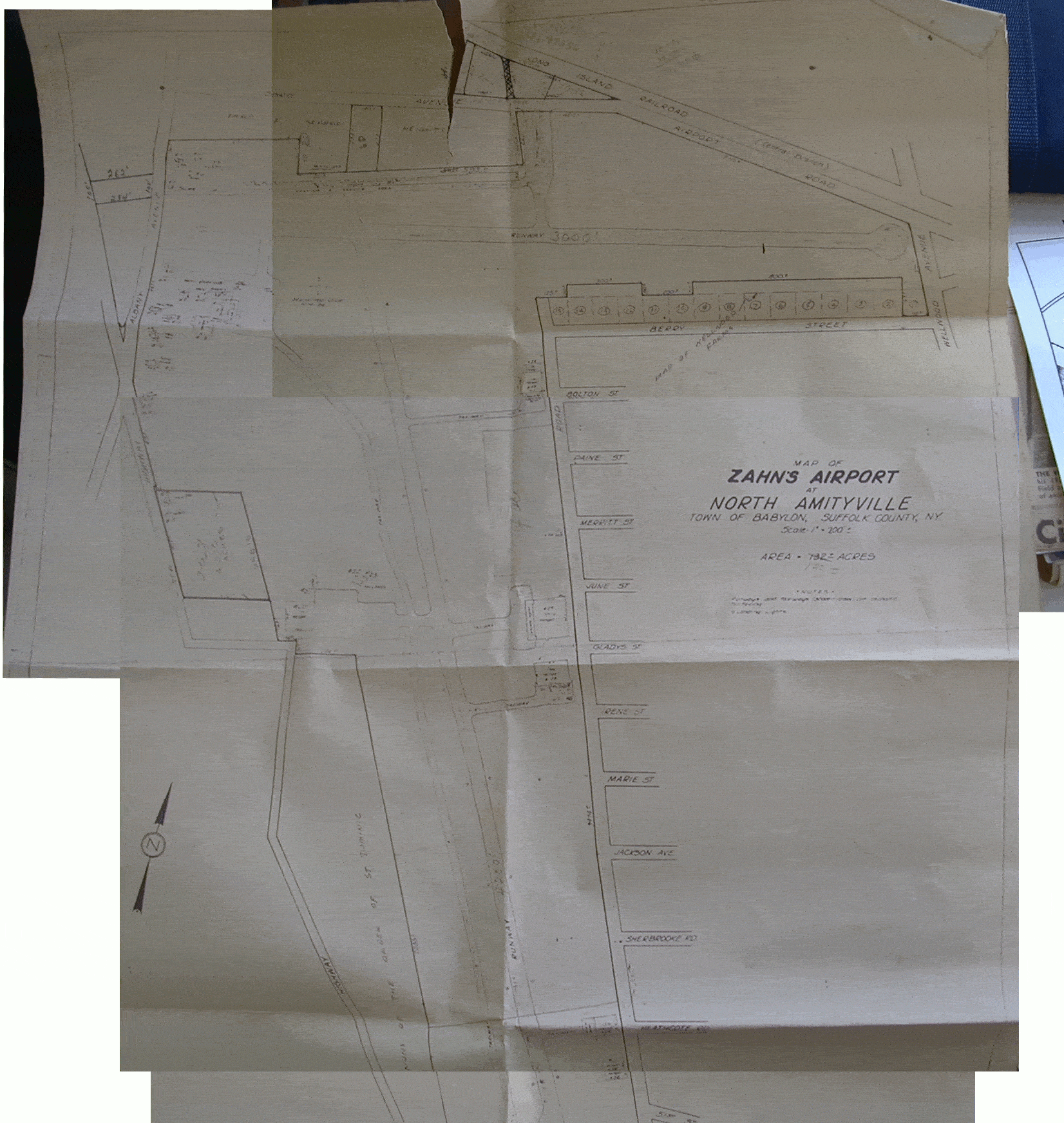
All of the X-Plane scenery building tools require very accurate longitude and latitude coordinates for scenery placement. The next step was to map Zahns — an airport that disappeared in 1980.
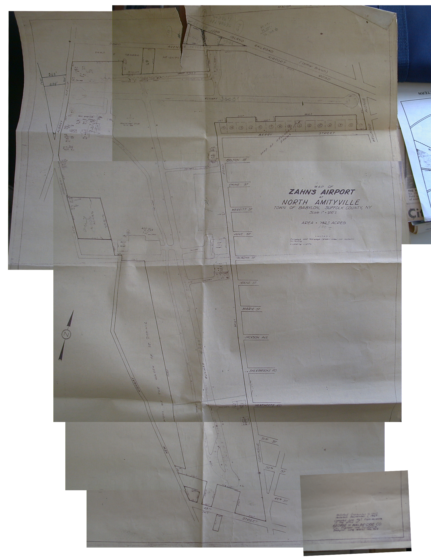
On a visit to New York, the Cradle of Aviation Museum granted me special access to their archive area, where I found a 1967 map of Zahns, commissioned by the Town of Babylon.
The map showed the locations of runways, taxiways, run-up areas, hangars, and quite a bit more — including street names and locations.
But it lacked longitude and latitude.
Google Earth
The next step was grabbing tools like Photoshop and GIMP to create a Google Earth overlay for the map.
The position of most of the streets around Zahns had not changed since 1980.
Using those streets as reference points, I was able to create a very usable Google Earth overlay.
I now had easy access to longitude and latitutde values for any point on the map.
Historic Aerials
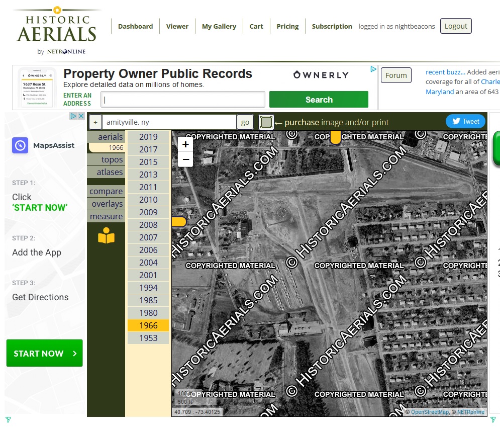
HistoricAerials.com was an invaluable resource for precisely placing runways, taxiways, and buildings.
For this project, the site has aerial photos and topographic maps from 1953, 1966, and 1980.
The ‘zoom’ feature of the aerial photos lets you get very accurate longitude and latitude values.
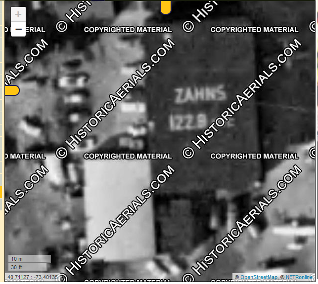
In this sample screenshot, we have an accuracy of 3.5 feet (0.0001 degrees). The zoom feature made it very simple to position and align the buildings with a very high degree of accuracy. By The latitude and longitude of the corners of each building also helped me assess the dimensions of each.
(The latest version of the HistoricAerials site now sells GeoTIFF versions — which would have made the job much simpler!)